 Nazione
 Landscape
 Beach
BeachEtna: Guided Summit Hiking Tour up to 3400m, Optional Pickup
5.481 reviews
Buy now
From 55,00€ per person
 Airport
 Attraction
 Citta
Citta Island
 Region
 Village
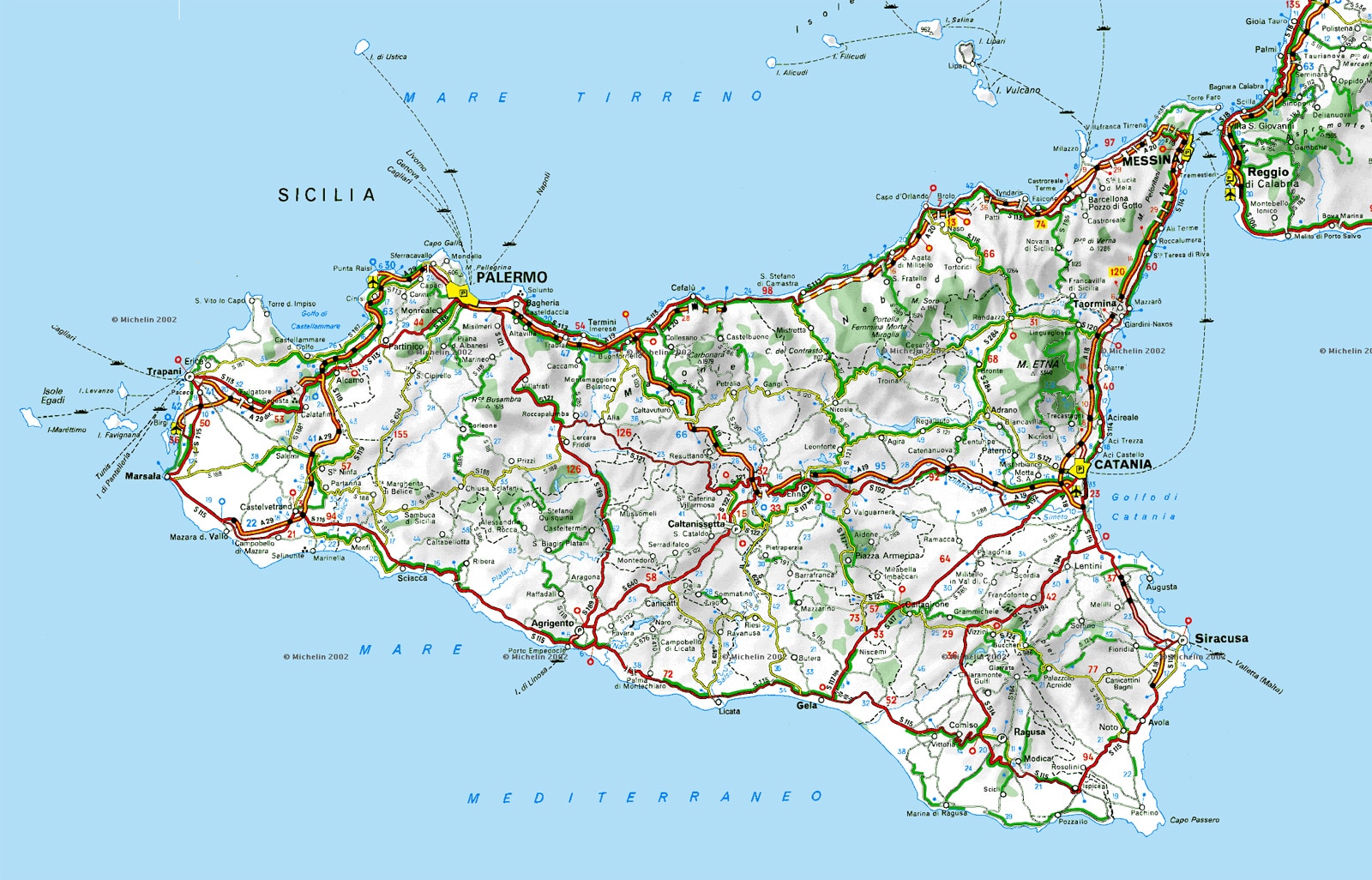
If you’re planning to explore Sicily by car and want to keep a detailed map close at hand, or simply fancy a proper digital detox, there’s nothing quite like a trusty road map.
If you’d prefer to print your own map, here’s a road map of Sicily showing the island’s main routes. You can download and print it.
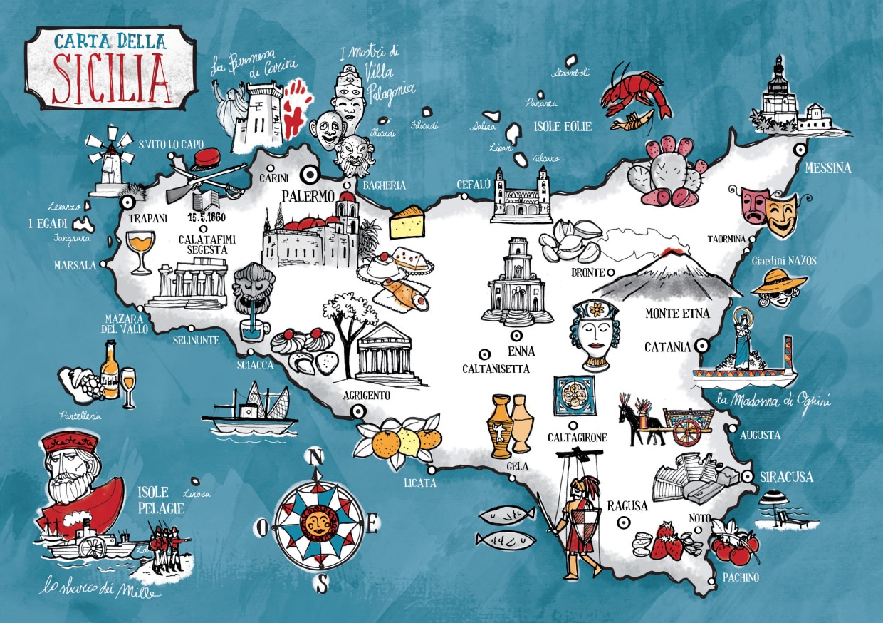
A beautiful illustrated map of Sicily showcasing regional traditions and specialities across the island. The PDF file is available to download here.
Sicily is an island in the Mediterranean, situated south-east of mainland Italy, separated from it by the famous Strait of Messina, a stretch of sea just 3 km wide. It’s bordered to the north by the Tyrrhenian Sea, to the west by the Sicily Channel, to the south-west by the Sea of Sicily, to the south-east by the Malta Channel, and to the east by the Ionian Sea.
It’s a vast island—in fact, the largest island in the Mediterranean (and among the 50 largest in the world) and the biggest region in Italy.
From an administrative perspective, the islands of the Aeolian, Aegadian and Pelagian archipelagos form part of Sicilian provinces. Some of these islands (Lampedusa and Linosa) are considerably distant from mainland Italy and are actually much closer to Malta and Tunisia.
 Hotel
Hotel  Budget accommodations
  Apartments
  Family Hotel
  Luxury Hotel
  Resorts